When I first began teaching at the university level some twenty-five years ago, I found that the use of media in the classroom still was considered somewhat suspect. A number of my colleagues clearly felt that to employ films, slides—even overheads—in the classroom was akin to capitulating to the evil forces of the entertainment industry. “Real education” consisted of well-crafted lectures delivered with flair to an audience of industrious note-takers.
I soon found, however, that my attempts to convey the essence of Japanese history were often hampered by the inability of my students to visualize many of the cultural aspects to which my lectures made reference. They had no notion of what a samurai warrior looked like dressed in laced-leather/metal plate armor, nor of the architectural features of a shoin-style room. In response, I developed a series of slide-illustrated lectures which I used to review each of the several historical epochs into which I divided my consideration of the Japanese past.
Yet I quickly realized that complementing my formal lectures with such visual reviews of the material failed to accomplish my initial intentions. Students persisted in holding an iconographic view of, say, what a “castle” ought to look like, even if that structure were located in Japan. I sensed that the average student, no less than my colleagues, looked at the instructional use of media as essentially a matter of passive entertainment and “time-wasting” more than anything else. I also came to recognize that a major part of the problem was that students had never been taught how to approach visual materials interactively as a source of useful information.
That realization led me to develop a set of two Visual Literacy Exercises. These slidebased instructional modules were structured so as to convey to students through an active learning experience several key aspects of the optimal approach to visual sources of information. One focused on the traditional Japanese conception of feminine beauty, utilizing slides from a commercially available set commemorating an exhibition of ukiyo-e hanga mounted in 1969 at the UCLA Art Gallery and later at the Freer Gallery in Washington, D.C.1 The other (the focus of my comments in this article) employed as its source material selections from Hiroshige Ando’s woodblock print series on the Fifty-Three Stations of the Tokaido and served the dual purpose of introducing aspects of Japanese geography to my student audience.
brief biography of the artist), then requests students view a series of fifteen woodblock prints by Hiroshige Ando.
Each module first asked students to look at a series of illustrations viewed in silence without commentary or explanation of any kind, then to write out answers to a set of questions they had not seen prior to viewing the slides about the content of what they had just seen. In the case of the Hiroshige prints, for example, after viewing the slide set, they were given a worksheet and asked to comment on the specific geographical features and climatic characteristics directly observable in the prints; they were also requested to note any evidence of human adaptation to these elements of geography and climate—ways in which the Japanese worked to accommodate the physical setting and seasonal variations encountered in their geographical surroundings. Students then repeated the entire exercise (now aware, however, of what information they were being asked to acquire) and added any newly observed information to their lists. Finally, they were asked to determine which half of the exercise was easier to complete and why — and what insights into the nature of dealing with visual information they might have gained as a result of completing both halves of the exercise.
Classroom presentations of the exercises were followed by a discussion of findings, with respect both to the subject matter illustrated in the slides (Japanese conceptions of feminine beauty in the first case, Japanese geography and climate and human adaptation thereto in the second) and the visual literacy insights gained from completing the experience. These discussions generally served to illustrate the following as characteristic of the best approach to learning from visual materials:
HAVE CLEARLY IN MIND WHAT YOU
HOPE TO FIND OUT FROM YOUR
INVESTIGATION OF THE AVAILABLE
VISUAL MATERIALS
Formulate questions to guide your information search. Know what you are looking for as you look at the source material. (Students preferred knowing that they were expected to gather information about geographical features from the woodblock prints, for example, a quest not known when first viewing the materials in the exercise.)
SUPPLEMENT THE VISUAL
MATERIAL WITH WRITTEN SOURCES
DEALING WITH THE ACTUAL
ITEMS THEMSELVES
OR WITH THE SUBJECT MATTER
YOU ARE INVESTIGATING
Read picture captions or catalog entries; search out articles and books dealing with the subject you are examining. This insight was emphasized most in the exercise about feminine beauty wherein a spoken commentary accompanied the second viewing of the illustrated materials, adding information and pointing out details likely to be missed otherwise.
REVIEW THE MATERIAL
MORE THAN ONCE
A second viewing often highlights items missed the first time around and encourages comparisons among items viewed. First impressions may give way to a fuller and more complete understanding as one proceeds through the material at hand; a second run-through often brings to the fore insights not considered at first glance.
Both classroom exercises were accompanied by worksheets guiding students through the entire process and asking for specific responses at designated points along the way. I subsequently used these interactive forty-five minute exercises each time I taught my courses on Japan and came to regard them as an essential ingredient in assuring that students made the most of the various other visual source materials introduced into the subject matter of the course. They also helped begin the fruitful consideration of key elements of Japanese geography and climate when taken up in greater detail later in the course.
With the passage of time, I found these exercises became even more important and valuable as more and more visual information flooded into the classroom: commercial films, video, documentaries, and art books, along with numerous illustrated volumes on various aspects of both traditional and modern Japanese culture and civilization. Both exercises, then, became essential ingredients in my teaching arsenal.
The original exercise format remained essentially frozen as a classroom-centered, slide-based experience for the next two decades or so. Then came the advent of the Information Age, the Internet and the World Wide Web. In 1996 I had the full set of fifteen Hiroshige slides “digitized,” then designed and implemented a Web-based version of the initial visual literacy exercise dealing with Japanese geography.
The “new and improved” version followed the same format as the classroom-centered exercise but incorporated several new features as well. I was able to lift out various pictorial elements from within the original woodblock print set and highlight them in separate scans, thereby pointing to details I would otherwise have brought to student attention in the classroom only verbally. I added a brief biography of Hiroshige, a map of the Tokaido, and descriptive labels locating each print along the highway and in its appropriate publication series.
The biggest challenge was writing an introductory essay explaining the purpose of the exercise and outlining the appropriate procedure to follow. Attempting to anticipate how a student might work through the material independently proved sobering indeed! Fortunately, a quarter century of classroom experience came in handy in this particular case.
Finally, I added a set of instructions for teachers who might access the Internet site and wish to implement the exercise in their own classrooms, and a brief essay describing what an attentive viewer might have been able to identify in the exercise materials. To give everyone who completed the experience an opportunity to comment, I devised an on-line evaluation form as well. After two experimental monitored evaluations in a classroom setting, the finished exercise was uploaded to the university computer system in December 1996.
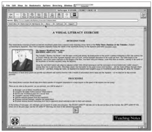
The Internet-based version of the exercise on Japanese geography begins with an overall introduction (including a brief biography of the artist), then requests students view a series of fifteen woodblock prints by Hiroshige Ando. The prints are unlabeled, presented without any commentary, and students are left in the dark as to why they are looking at these illustrations and for what purpose.
This section of the exercise is followed by a worksheet (which can be printed out for individual completion off-line) asking the questions about physical and climatic features mentioned earlier in the article. After filling in the worksheet, students are led to review the slide set again, this time encountering added captions and commentary where appropriate.
Next, students are given an opportunity to add items to their lists of responses, then asked to evaluate the lessons learned from having completed the exercise. Suggested responses to each question asked on the worksheet are provided at the conclusion of the exercise so that even independent learners have the advantage of learning what information about Japan’s geography and climate a careful observer might glean from looking closely at the slide set. Teaching notes can be found on the site as well for those contemplating the use of the exercise in an instructional setting. An evaluation form provides useful feedback information to the site author.
The first set of students exposed to this newly constituted visual literacy exercise illustrating aspects of Japanese geography was assigned the Web-based exercise during the Winter Quarter of the 1996–97 academic year at Cleveland State University as part of a course on the history of traditional Japan. The results surpassed my expectations. Every student completed the exercise, a fact ascertained both by access figures generated by the site itself and by the completed copies I received of the exercise sheet (accessible only on the Web site and not distributed in class).
Furthermore, the written responses were both more extensive and thoughtful than those completed during the thirty minutes or so usually devoted to the written portion of the exercise in the classroom. In an end-of-quarter course evaluation session, students voiced particularly their appreciation for the opportunity presented to view (and review) the material at their own pace and to complete the exercise at their individual convenience rather than as part of a group experience. Many thanked me for introducing them to the Internet—for several the exercise assignment provoked their first experience with on-line resources, one that led to extensive further “surfing”!
Comments from other Internet visitors have confirmed as well the utility of this active learning experience even outside its initially intended university-level educational setting. The exercise has been completed successfully by many off-campus, nonstudent visitors to the site.
In the end, this entire ongoing developmental process has provided me not only with a useful visual literacy exercise and a structured centerpiece for the introduction of Japanese geography in my own college classroom, but also with an opportunity to contribute to the larger educational enterprise—a learning module for use in a variety of other settings. Check out the final product at the following Internet address: http://www. csuohio.edu/ history/exercise/vlehome.html. Let me know your reactions.
NOTES
1. See Harold P. Stern, Master Prints of Japan: Ukiyo-e Hanga (New York: Harry N. Abrams, Inc., 1969), the exhibition catalog.
BIBLIOGRAPHY
Stern, Harold P. Master Prints of Japan: Ukiyo-e Hanga. New York: Harry N. Abrams, Inc., 1969.